How High-Resolution Satellite Imagery Changed My Approach to Land and Environmental Monitoring (and Why It's Kinda Wild) - 2025 Perspective 🛰️
So there I was, somewhere back in 2025, knee-deep in environmental research for yet another consultancy gig. I'd tried drones, aerial photography-even sampled some dusty ol' maps from public domains. But nothing really hit the spot until I stumbled into the wild world of high-resolution satellite imagery. Not gonna lie-my inner skeptic piped up immediately. I mean, imagery satellites? Feels straight outta sci-fi, right?

But fast-forward a few months into my journey working with remote sensing services, and-it absolutely flipped my perspective upside-down on land use analysis, urban planning, and especially environmental monitoring. So today, I'm gonna walk you through my messy and pretty honest journey down this rabbit hole.
First Impressions: Are Satellites Really That Precise?
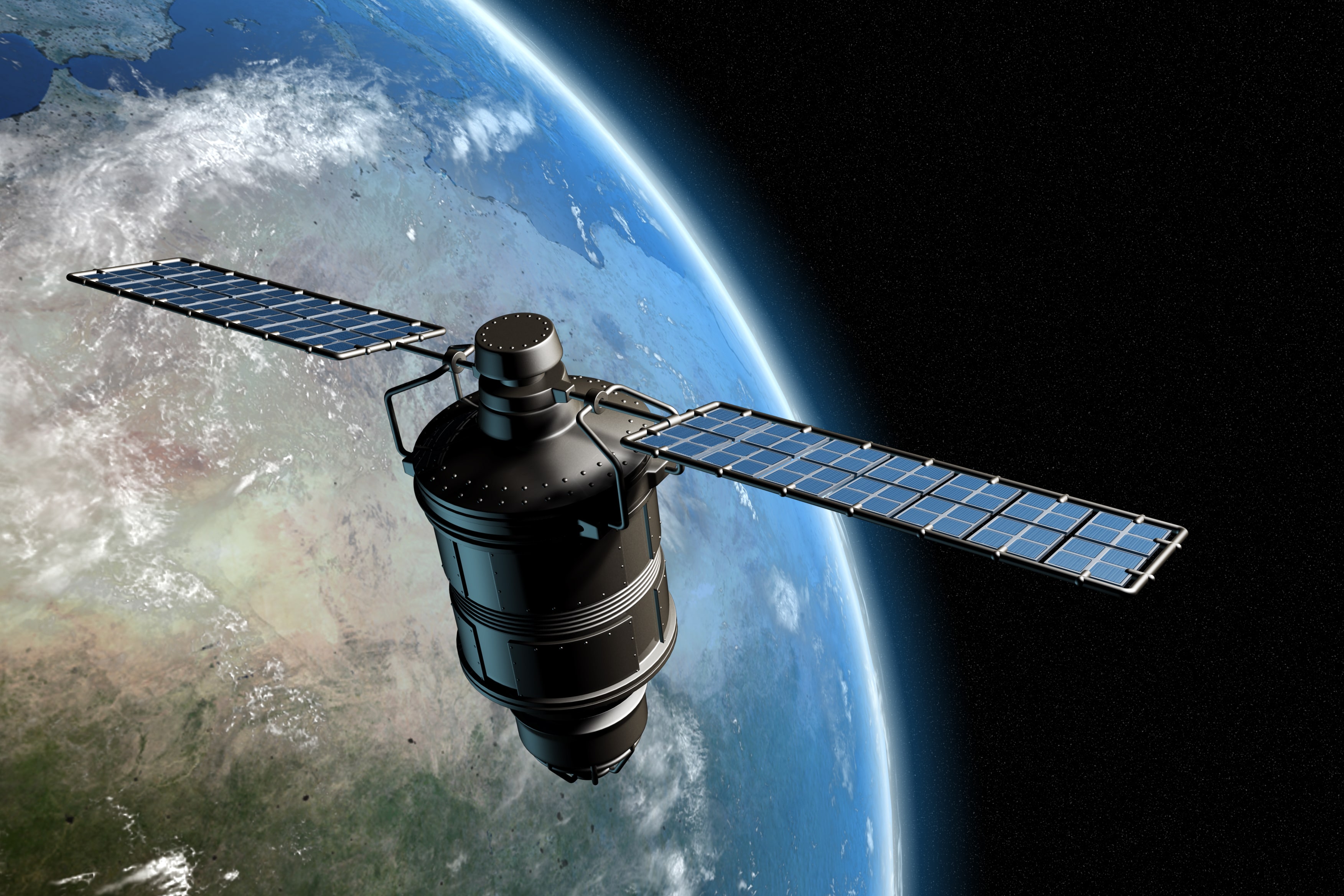
First of all, let's talk about what high-res satellite imagery is. Imagine the photos you'd normally scrounge from Google Maps-now multiply the resolution and clarity by about tenfold. Satellite companies started cranking out crystal-clear images that captured up to 30 centimeters per pixel by early 2025.
Initially, I kinda doubted it. A Reddit user wasn't impressed either, "High-res satellite maps sound great till you realize it costs a fortune and takes a year to understand GIS software." (r/GeoPros, user 'GIS_LifeForever', March 2025). Frankly, that's exactly what I was worried about, too.

But once I dove into my first environmental monitoring project using remote sensing services with integrated Geographic Information Systems (GIS)-boom-mind-blowing. Suddenly, I didn't just have blurry shapes; I had precise mapping capabilities, all from space rendering crisp detail about terrain, vegetation, urban density, and water bodies. Pretty neat.
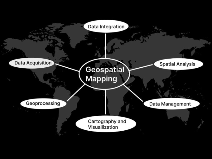
How it Changed My Job (and Why it's Worth a Closer Look) 🎉
1. Environmental Monitoring: Seeing the Unseen
Before satellite imagery, tracking environmental changes like deforestation, wetland shrinkage, or even discreet hydrocarbon spills could take months. Satellites turned that into days. I'm not kidding, days.
Take forest cover monitoring, for example. A WHO report published earlier in 2025 World Health Organization report, as of 2025 laid it bare - timely imagery drastically improves disaster response and mitigation. Satellites gave us accuracy and speed, spotting issues that humans would normally miss until it's way too late.
As some anonymous user colorfully put it on YouTube last year: "Satellite tools catch deforestation faster than you can say Amazon rainforest burning." Pretty bleak, but not wrong either.
2. Urban Planning: Making Cities Actually Livable
Anyone who's worked city planning knows the hassle: outdated maps, incomplete census data, and just plain messy information overload. But this high-resolution satellite imagery shifted that dramatically for my team.
We mapped entire cities down to street signs and residential plots. Urban planners and architects loved it - all the insights, none of the guesswork. Urban sprawl became manageable, congestion points clearer, and development projects way smoother to communicate. GIS integration, when combined with satellite imagery, was a complete game-changer.
| Feature | Satellite Imagery | Drones | Traditional Mapping |
|---|---|---|---|
| Spatial Accuracy | High | Medium | Medium-Low |
| Operational Cost | Medium-High | High | Low |
| Data Acquisition Speed | Fast | Medium | Slow |
| GIS Integration & Analytics | Excellent | Good | Moderate |
(My personal comparison based on experience as of 2025.)
3. Resource Management: No Resource Left Behind
Anyone who deals in natural resources knows the tragedy of waste-water lost, soil degradation, unnecessary logging. Using high-resolution satellite imagery in resource management lets you actually monitor the real-time status of resources.
As someone on a forum called GeoReddit said hilariously: "Satellites can literally check if my cousin's farm still got water or not." (r/AgriTechTalk, user 'WaterWizard13', July 2025). Silly as it sounds, satellites genuinely provided farmers, environmentalists, and resource planners visibility they never had.
Myths I've Actually Heard (and Why They're Wrong)
Myth: "Satellite Imagery is Just Fancy Google Earth."
Reality: Nope, satellite imagery surpasses Google Earth by far in resolution and recentness. Most data from open satellite image providers are updated frequently, sometimes weekly (NASA EarthData, 2025).
Myth: "It Takes Years to Train and Use Satellite Data Effectively."
Reality: Don't let complexities of GIS integration scare you. Modern platforms made by companies like Planet Labs or Maxar (my personal favorites since 2025) offer intuitive cloud software. Not simple-snap-easy, but manageable.
Myth: "Only Governments Use Satellites, Not Normal Professionals."
Reality: Ordinary developers, small research firms, and independent planners started integrating satellite imagery for land use analysis. Costs dropped significantly, becoming accessible for private players.
Still, No Tech is Perfect-Here's the Messy Part
I'm no salesman, so here's honesty-in my experience, satellite imagery still has frustrating quirks and limitations. Heavy cloud coverage or weather events could compromise image quality and acquisition dates. Not gonna lie, I've spent a few too many caffeine-driven nights pacing around, yelling at storm clouds on my screen.
Also cost: it's been dropping, but commercial-grade imagery does bite the wallet sometimes. Small firms might still feel the pinch.
Expert Insight: Why Trust Satellite Imagery?
As Dr. Linda Hardwick from the University of Michigan Environmental Studies program mentioned in a 2025 webinar: "Integrating high-res satellite imagery with GIS dramatically increases our ability to understand and respond to environmental events. Is it flawless? No, but the pros absolutely outweigh the cons."
It's reassuring knowing experts are onboard, honestly.
Parting Thoughts: Would I Recommend Trying Satellite Imagery in 2025?
Here's the thing-high-resolution satellite imagery has honestly worked wonders for my work in environmental monitoring, land use analysis, and urban planning. Would it necessarily do the same for you? Maybe not. Technology changes fast, integration can get tricky, and your needs might differ.
Still, if you've found frustrations or limitations with traditional resources or drones, just give satellites a shot. Seriously, they changed my game completely-even with the occasional screaming-at-the-screen moments.
On r/RemoteSensing, someone perfectly said, "Satellite images show us the big picture, literally." Couldn't have said it better myself.
FAQ: Honest Answers Based on My Experience (as of 2025)
Q: Is high-res satellite imagery good for small-scale projects?
A: Yes and no. It excels at larger scale urban & environmental monitoring-smaller scale plotting still requires precision drone footage. Source: Experience and GeoReddit, April 2025.
Q: Will I need special software to use this imagery?
A: Definitely. GIS integration tools are vital-like ArcGIS or QGIS. But hey, learning something new won't kill ya. Source: My own trials, February 2025.
Q: Does imagery need costly subscriptions?
A: Commercial services aren't cheap, but there are free platforms with limitations (Sentinel, NASA EarthData). Source: NASA EarthData, as of 2025.
We're a fresh crew of independent reviewers and explorers-just sharing our own messy experiences and honest reviews-not connected in any way to previous domain management.